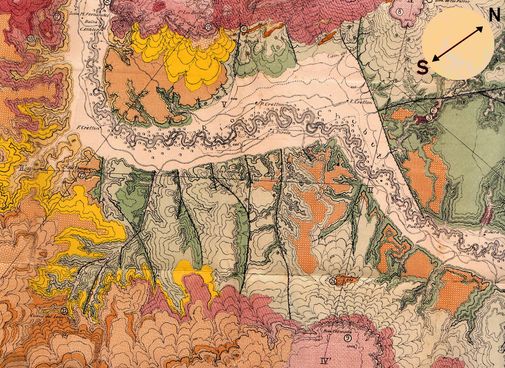
Cartography and Topographic Maps. Geometric Relations between Topographic Relief and Geological Surfaces. Remote Sensing – Interpretation of Aerial Photographs. Identification of Geological Formations and Geological Contacts: principles and Morphotectonic Characteristics. Chronology of the Geological Events. Complex Structures. Isopach Maps.
Tectonic Structures, Folds – Faults: Geometric, Kinematic and Dynamic Characteristics. Tectonic Stresses and Deformations. Stereographic Projections.
Interpretation of Geological maps and construction of Geological Cross Sections.
Maps of Regions with Economic or Engineering Interest. Geological Maps and GIS.